The inter-comparison of measurements between laboratories, who work on the accuracy of Copernicus Sentinel Ocean Colour and Sea Surface Temperature products, are an important component of quality checks of data collected in the field. Last year on the AMT4SentinelFRM research voyage, Plymouth Marine Laboratory (PML) carried out an inter-comparison exercise in collaboration with the EU Joint Research Centre, Italy, on optical data collected from the ship that is used for the validation of satellite ocean colour products.
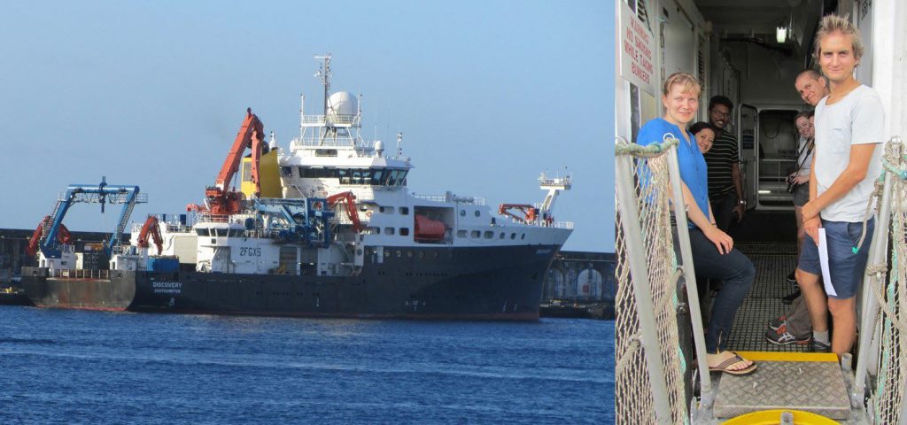
On this year’s AMT4SentinelFRM research voyage, under the research project Fiducial Reference Measurements for Sentinel Ocean Colour (FRM4SOC), a further inter-comparison exercise is being carried out with The Royal Belgian Institute of Natural Sciences (RBINS) and Tartu Observatory (TO), Estonia, comparing long track and on station above water radiometric measurements using different optical sensors. Gavin Tilstone and Francesco Nencioli from PML have been joined by Quinten Van Hellemont from RBINS and Krista Alikas from TO on RRS Discovery to make these measurements.


Fiducial Reference Measurements are independent sea-surface measurements that provide confidence in satellite data products. For ocean colour, optical sensors are used that are designed to retrieve the spectral distribution of upwelling radiance just above the sea surface, which is what is measured by the Sentinel-3A satellite. The upwelling radiance is then used to estimate the chlorophyll-a concentration as a proxy of phytoplankton biomass.
The PML team are using optical sensors manufactured by SATLANTIC in Canada, and the RBINS and TO teams are using sensors manufactured by TRIOS in Germany. These sensors are similar in design, but there are subtle differences between them.
The inter-comparison helps to understand the effects of different instrument design on the upwelling radiance measurements, which helps to provide confidence in the data collected by both sets of sensors.
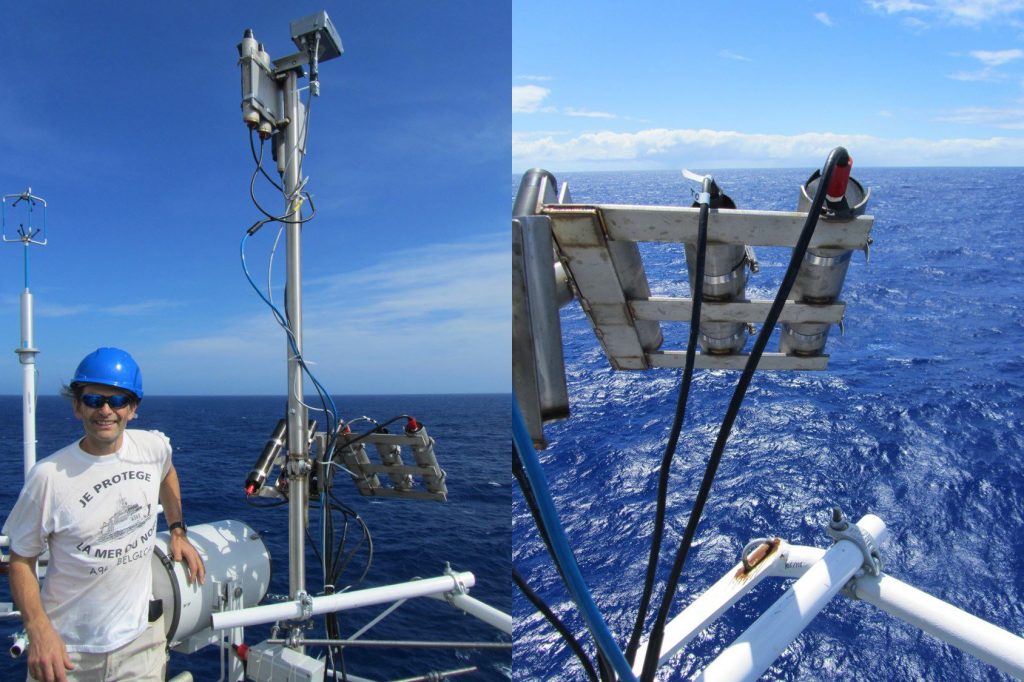
To facilitate these comparisons, PML designed a purpose-built stainless steel frame to put all of the optical sensors at the same viewing geometry so that they receive upwelling radiance from the same patch of water.
Prior to the research voyage, the steel frame was bolted to the rails of the met platform on RRS Discovery, from which the sensors have an unimpeded view of the surface of the ocean. Each institute uses three optical sensors; one that measures the radiance of the sky, one that measures the radiance from the water in front of the ship, and a third that points directly at the sky and measures the sky downwelling irradiance. The sky and water radiance sensors are positioned at 40 and 140 degrees from zenith. A tilt and heading sensor is used in conjunction with the other sensors to provide GPS position and angle of the sensors with respect to the motion of the ship.
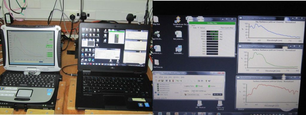
Krista has also installed a fish-eye camera that looks upwards to produce a photographic log of the sky conditions. These images are used as quality control check on potential match-up scenes with the Sentinel-3A satellite. The instruments are connected via a junction box and data is transferred through a mini-deck unit to a laptop in the met laboratory.

Each day, at approximately the time that the Sentinel-3A satellite orbits over-head, the ship stops and is positioned at a 90 degree angle from the Sun. This ensures that there is no direct sun glint shining onto the sensors.
A series of measurements are then logged for 10 seconds over an hour period to collect essential data to truth the satellite measurements.
By deploying the sensors during the AMT4SentinelFRM research campaign along the Atlantic Meridional Transect (AMT), a comparison of the sensors is achieved continuously between the UK and the sparsely sampled South Atlantic along a 11 000 km track.
The transect covers several ocean provinces in the North and South Atlantic Gyres, and also the productive waters of the Celtic Sea, Patagonian Shelf and Equatorial upwelling zone. This offers a lot of variability for the FRM4SOC inter-comparison exercises.
There are few sites in the blue water oligotrophic gyres that are used for validating satellite data because of the cost of accessing and maintaining measurement platforms in such remote locations. This voyage provides a fantastic opportunity to conduct both field inter-comparisons at these sites and, at the same time, to validate Sentinel-3A products using different ship-based sets of optical instruments. PML, RBINS and TO made continuous measurements for nine days from the UK to the Azores, where Quinten and Krista disembarked. Krista left the TO sensors on the ship so that a comparison with the PML sensors could be carried out all the way down to South Georgia and the Falkland Islands.

The AMT was started as a programme for determining the accuracy of ocean-colour satellite data and provided vital validation data to evaluate the accuracy of NASA’s SeaWiFS mission and for the development of ocean-colour models of phytoplankton biomass.
Many of the early AMTs in the late 1990s were supported financially by NASA for the early pre- and post-launch work on the SeaWiFS. For the past two years, the validation of Copernicus Sentinel ocean colour, sea-surface temperature and ocean dynamic products has been funded by the European Space Agency to provide confidence in the satellite data products that will be used to monitor the ocean for the next 20 years.